UBC’s Rare Books and Special Collections houses a number of rare materials relating to the logging and forestry industry in Vancouver and its surrounding regions. One such collection is that of the Capilano Timber Company, which operated on the North Shore for a fifteen-year period between 1915 and 1930.
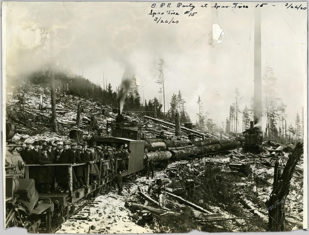
Canadian Pacific Railway party, 1920
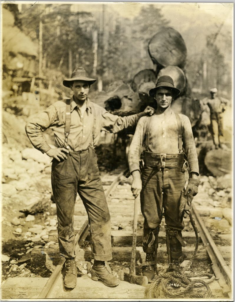
View of high rigger with axe standing beside another employee, 1920
In 1917, the American owned company began to aggressively log the watershed – the demand for high-quality lumber to construct aeroplanes during World War I meant the company received a high return on their investment. Given the steep terrain and narrow valleys on the North Shore, Capilano Timber Co. was forced to build a logging railway in order to get the timber to tidewater. By February 1919, 12.8km of track led in to the Capilano valley. Timber bridges were also necessary to move people and materials along the valley – the most impressive being the Houlgate trestle, which reached a height of 27 metres and spanned a length of 120 metres.
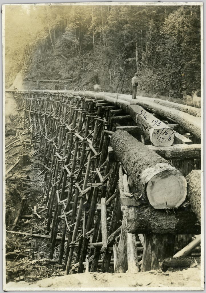
View of bridge construction, 1918
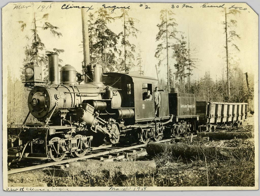
30 tonne Grand Locomotive, 1918
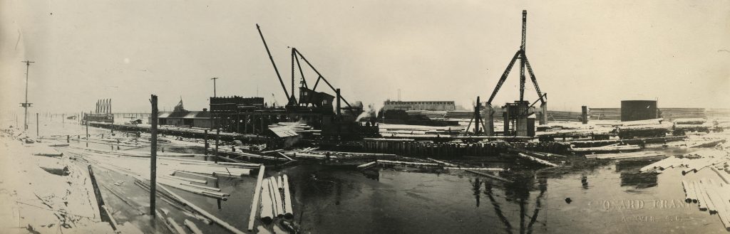
Log dump and derrick
At its peak, the Capilano Timber Co. employed 250 men cutting over 150,000 feet per day. Their living quarters were considered “civilization in the bush”: they had indoor taps running hot water, showers, and dining cars that served bacon, eggs and hotcakes for breakfast, and steaks, stews and pies for dinner. The company even invested in constructing houses for married couples, in order to attract a stable permanent workforce – although it’s not clear how successful this experiment was.
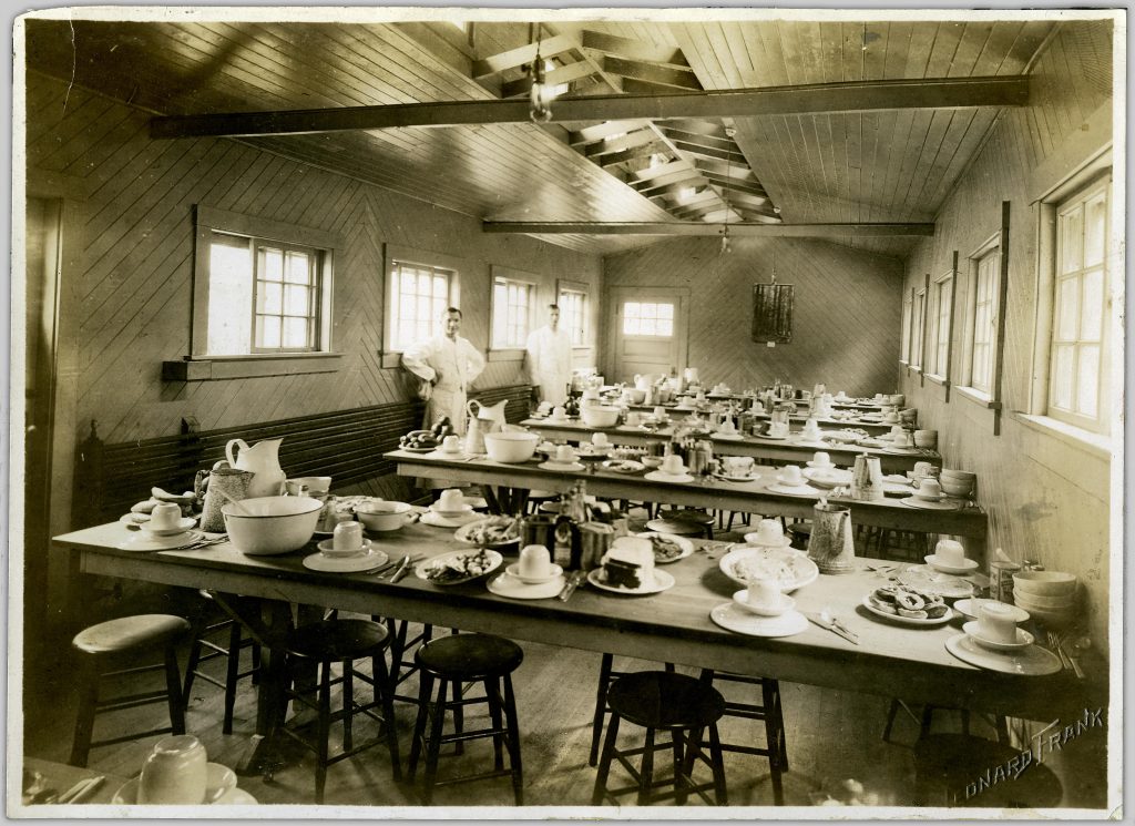
View of interior dining camp train car, 1919
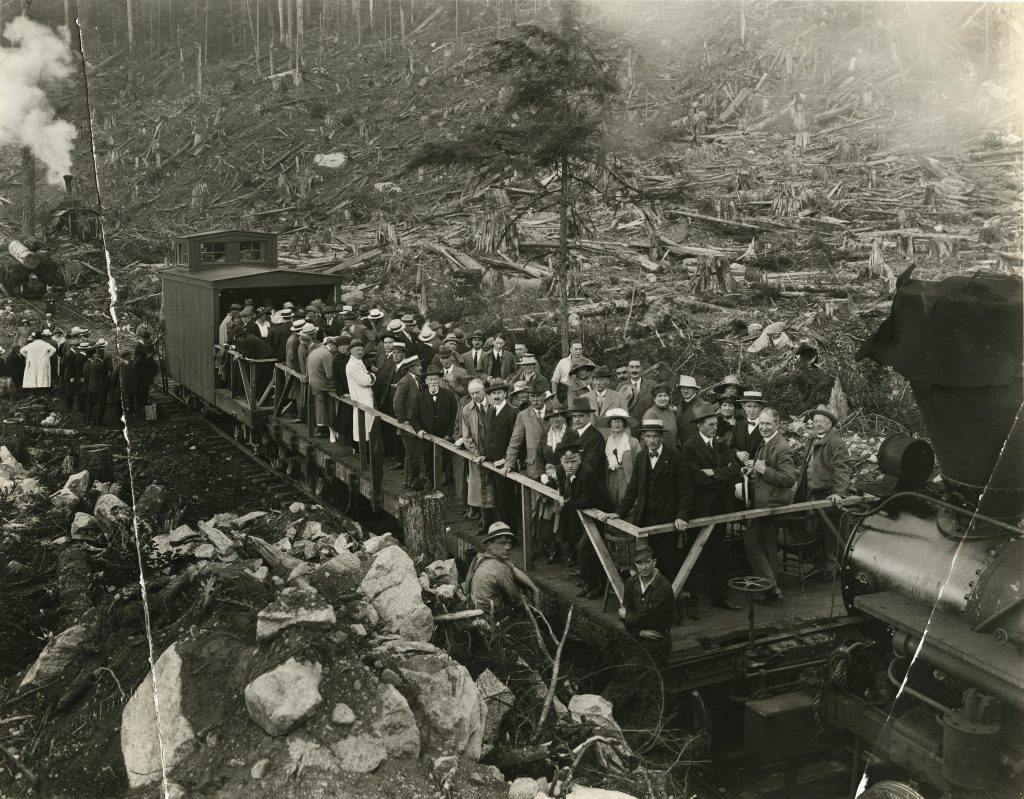
Train full of people observing a logged forest
In 1925, the Capilano Timber Co. sold unmanufactured logs to local mills; however, by 1926 they had completed their own mill, and began to process thousands of feet of cedar, hemlock and fir. Just when operations were expanding rapidly and profits were at their peak, the 1929 economic depression hit and the Capilano mill was forced to close down.
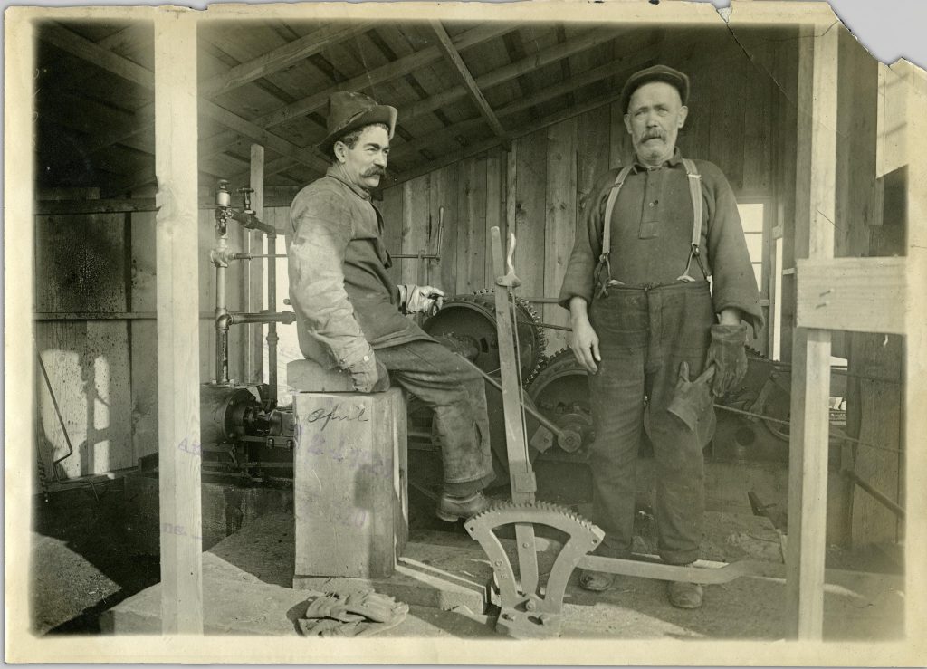
View of two men at work, 1920
In its fifteen years of operation, the company harvested approximately 400,000,000 feet of timber, laid 80 kilometers of railway tracks, and spent $9,000,000 on wages and equipment. The company also left in its wake clear-cut and barren forests which were prone to washouts and forest fires for decades after the company’s operations ceased. In the intervening years many conservationists and local governments have attempted to rehabilitate the Capilano watershed region, and today it’s a source of much of Vancouver’s potable household water. If you would like to learn more about the Capilano Timber Company, take a look at Anna Gabrielle Kahrer’s 1988 MA thesis paper titled Logging and landscape change on the north shore of Burrard Inlet, British Columbia, 1860’s to 1930’s in UBC’s scholarly repository, cIRcle. And be sure to check out the full collection of photographs in Open Collections!
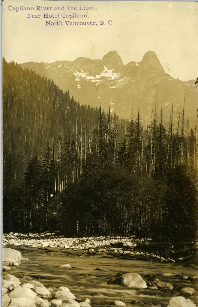
Capilano River and the Lions, North Vancouver B.C.


If you know where to look you can find traces of the Capilano Timber logging railway.
Timbers from the Houlgate trestle can be found in the creek.
Looking for photos of the rail link to the PGE and CNR which could be at the foot of Pemberton and east.
HI there
I would be interested in seeing the timbers from the Houlgate trestle. Do you know roughly where they can be spotted?
Hello,
Thanks for your interest in the post!
I’m not sure where you can spot the remains of the trestle and a bit of Googling hasn’t helped to shed much light unfortunately. Perhaps another contributor will be able to help you.
In the meantime however, I can suggest that they might be spotted in the Capilano River Regional Park Area, especially near Houlgate Park, which is in the northwesterly corner of the regional park.
A couple of tid bits in the meantime.
An image of what are likely the remains of the trestle in 1956 is available on the West Vancouver Library’s digital collection. The record says that the site of remains is “below the Cleveland Dam”. Here’s the link:
http://digital.westvanlibrary.ca/2838908/data?n=77
Seems some exploring is in order!
I believe I have the coordinates for the trestle and am planning on a hike in to see the remaining timbers if possible. It is off the Capilano Pacific trail where it crosses Houlgate creek. I believe it is about 30-50 meters above the current trail bridge.
Coordinates 49deg21’21.5N 123deg 07’05.5W
42.355957,-123.118189
Would enjoy a fellow enthusiast to come search with me.
N 49 21.418 W 123 07.154. Park at the end of Rabbit Lane and walk 400 m along the old railroad grade to Houlgate Creek
Park at the end of Rabbit Lane and walk about 400m along the old railroad grade to Houlgate Creek. Nothing remains of the trestle today, except maybe some timbers in the creek. It was still standing in 1982, but a slide a few years ago due to an inadequately engineered retaining wall may have taken the rest of it out.