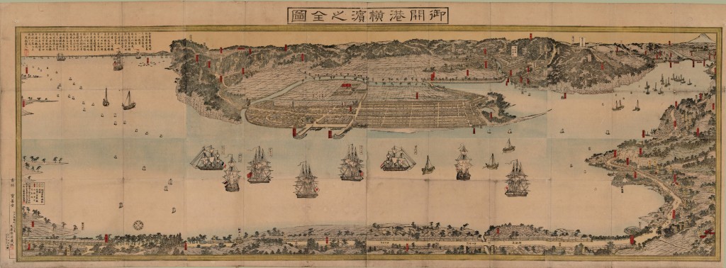
In 1858, Japan signed the Ansei Five-Power Treaties with the United States, Great Britain, Russia, Netherlands, and France. The following year in 1859, the port of Yokohama opened to foreign trade as specified in these treaties. 御開港横濵之全圖 Gokaikō Yokohama no zenzu marks the opening of the port and depicts ships from the five nations anchored in the bay. In this map, we are looking at the port of Yokohama from North West. North is not always at the top of Japanese maps.
There is a close tie between the Port of Yokohama and the Port of Vancouver. A Japanese ocean liner Hikawa Maru travelled between these two ports from 1930 to 1954, transporting Japanese immigrants to Canada. (Hikawa Maru is permanently berthed at the Port of Yokohama as a floating museum.) Yokohama and Vancouver are sister cities since 1965. The scene of this map reminds me of the English Bay, with oil tankers in place of the sailing ships!


