Now that the rainy season is finally ending, we’re ready to enjoy British Columbia’s beautiful beaches. For this post, we gathered together historic photos of B.C. beaches, from right here in the Lower Mainland to Powell River.
Starting locally, we found several photos of beaches at and near UBC in the UBC Archives Photograph collection. This photo of Wreck Beach from the 1980s shows the erosion of the Point Grey cliffs:
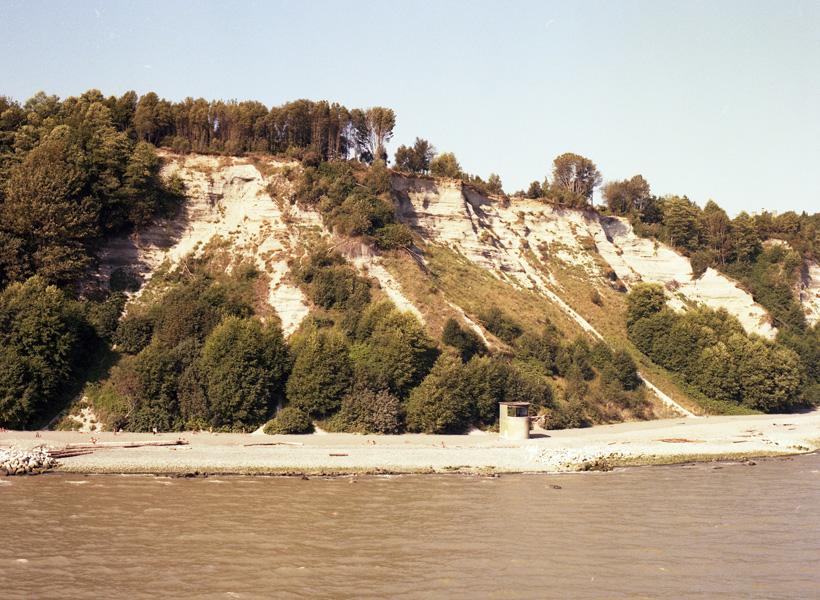
UBC 1.1/16555-8. Point Grey cliff erosion, aerial view, showing WWII searchlight tower and close-up of cliff-face, July 1983.
This photo of Jericho Beach from 1962 also shows the surrounding area, including West Point Grey and Kitsilano:
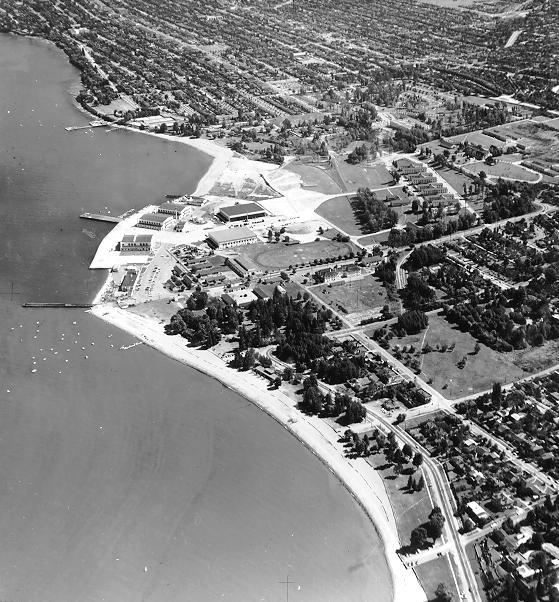
Holborne, Peter. UBC 1.1/3303. Aerial view of Jericho beach area, September 6, 1962.
Although the exact location of this photo within Vancouver is unknown, we love this beach attire from around 1900:
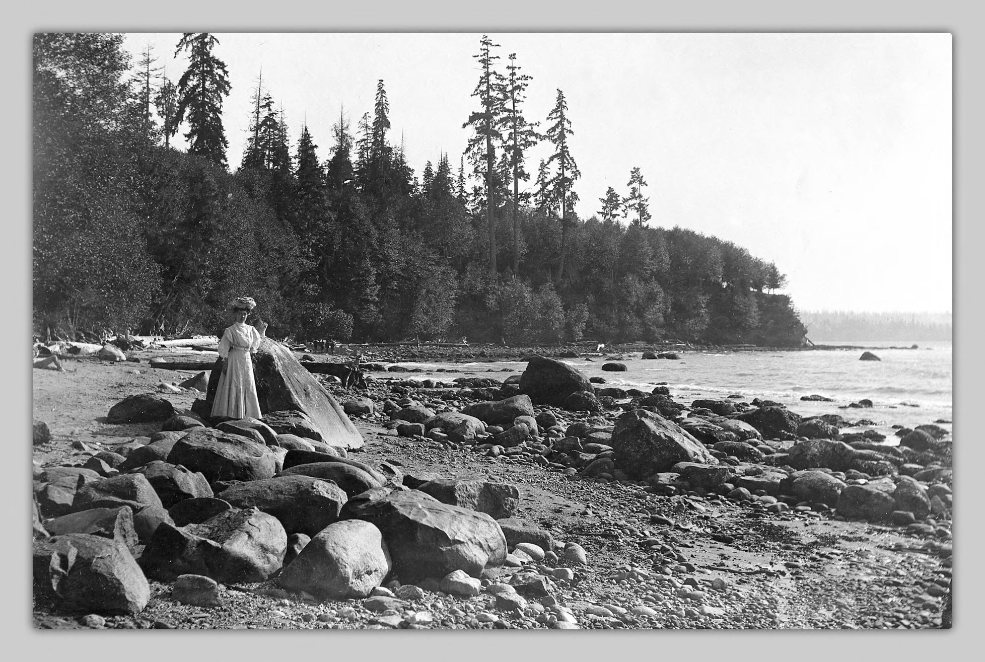
[Woman on a beach], [1900?].
These postcards show Kitsilano Beach in the early 20th century – check out the men’s suits in the first photo!
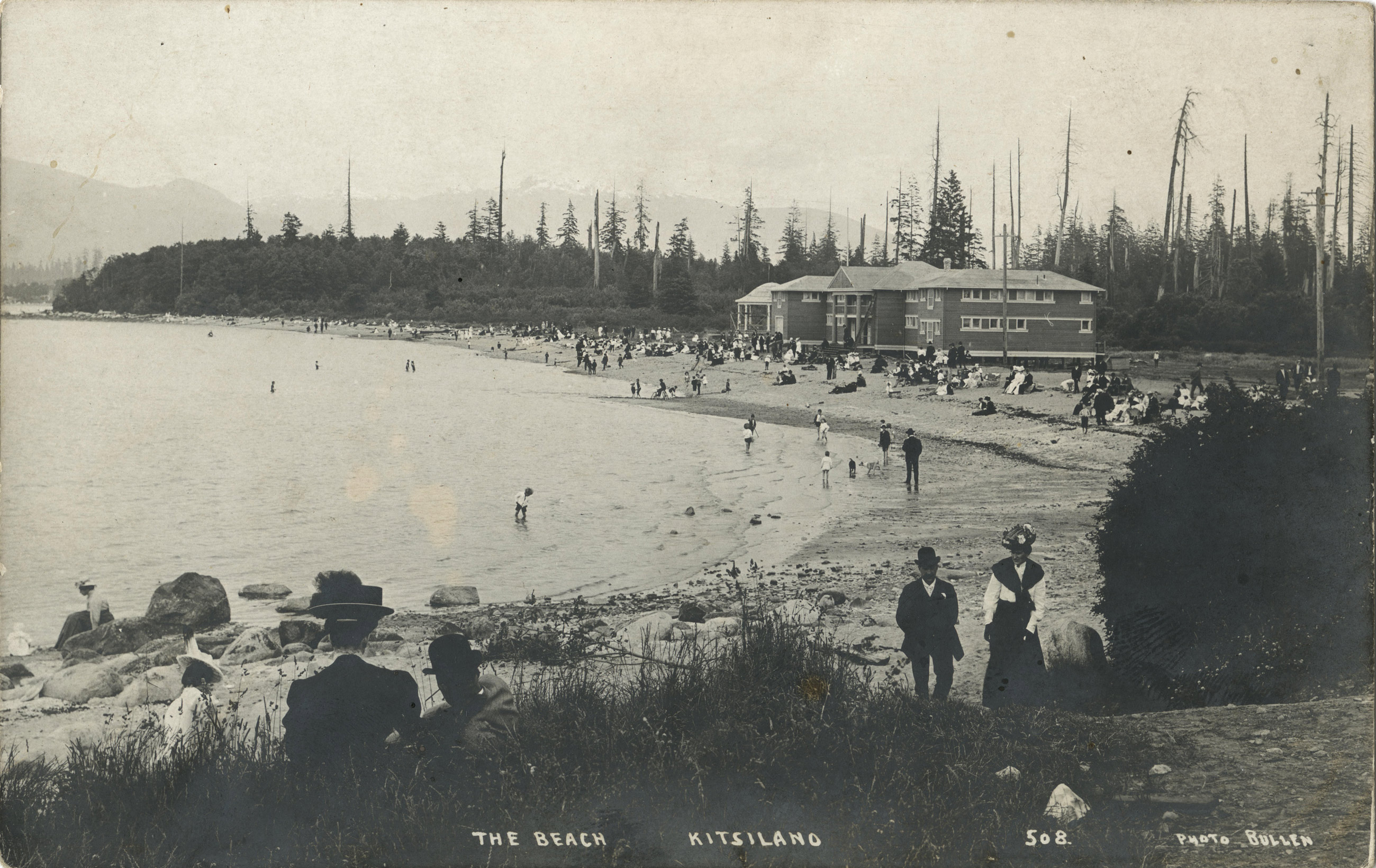
The Beach, Kitsilano, [between 1905 and 1915?].
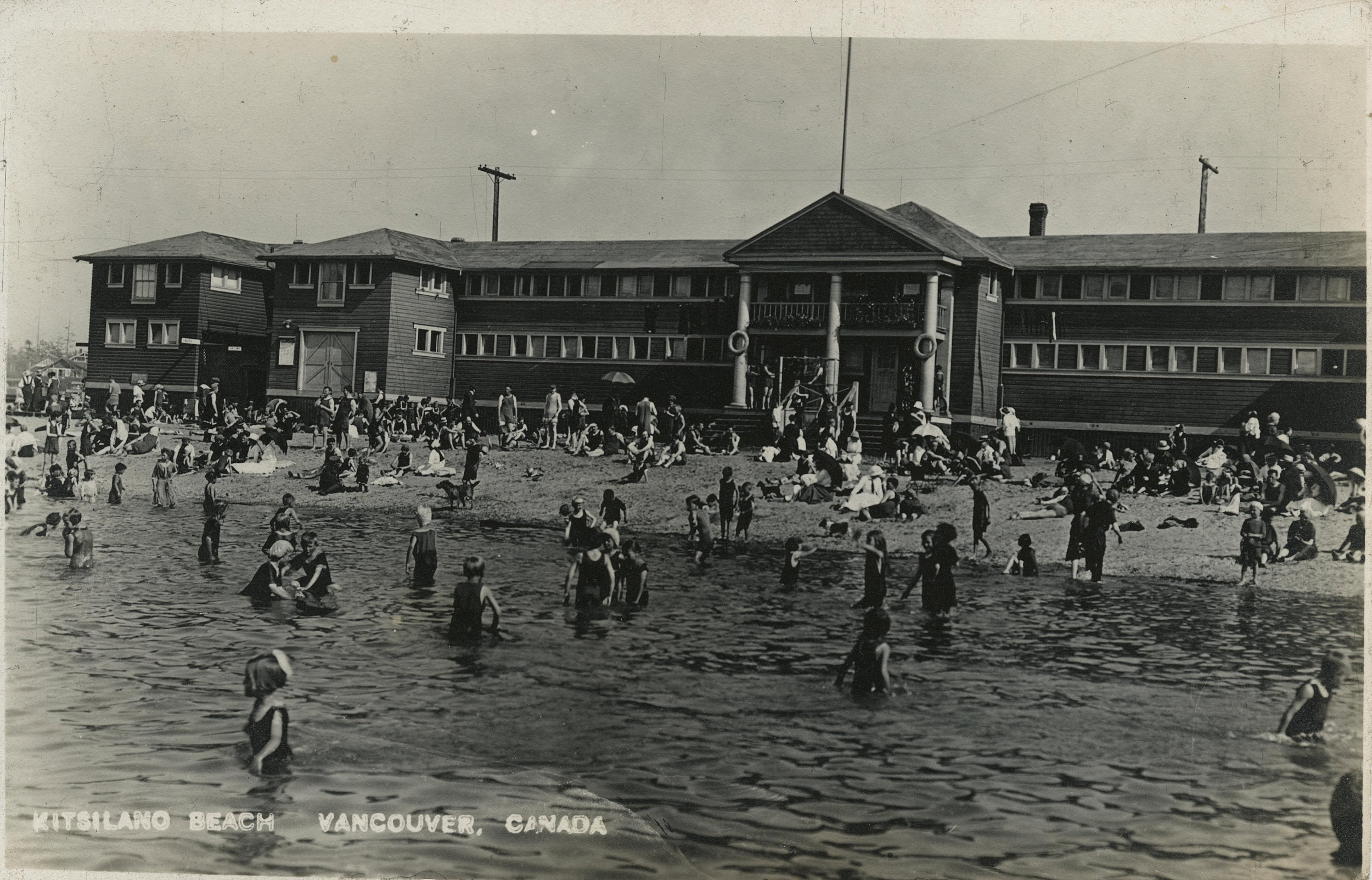
Kitsilano Beach, Vancouver, Canada, [between 1910 and 1935?].
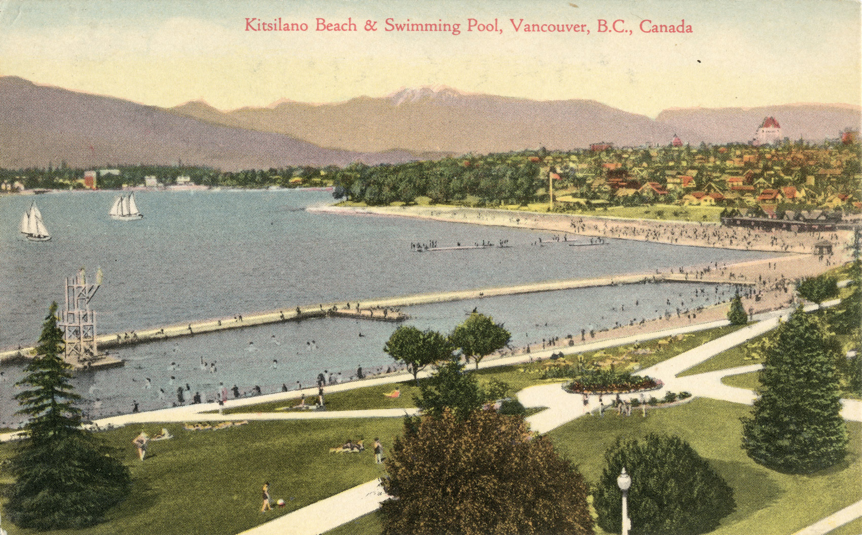
Kitsilano Beach and Swimming Pool, Vancouver, B.C., Canada, [between 1920 and 1930?].
We found several photos of English Bay and Second Beach, over by Stanley Park:
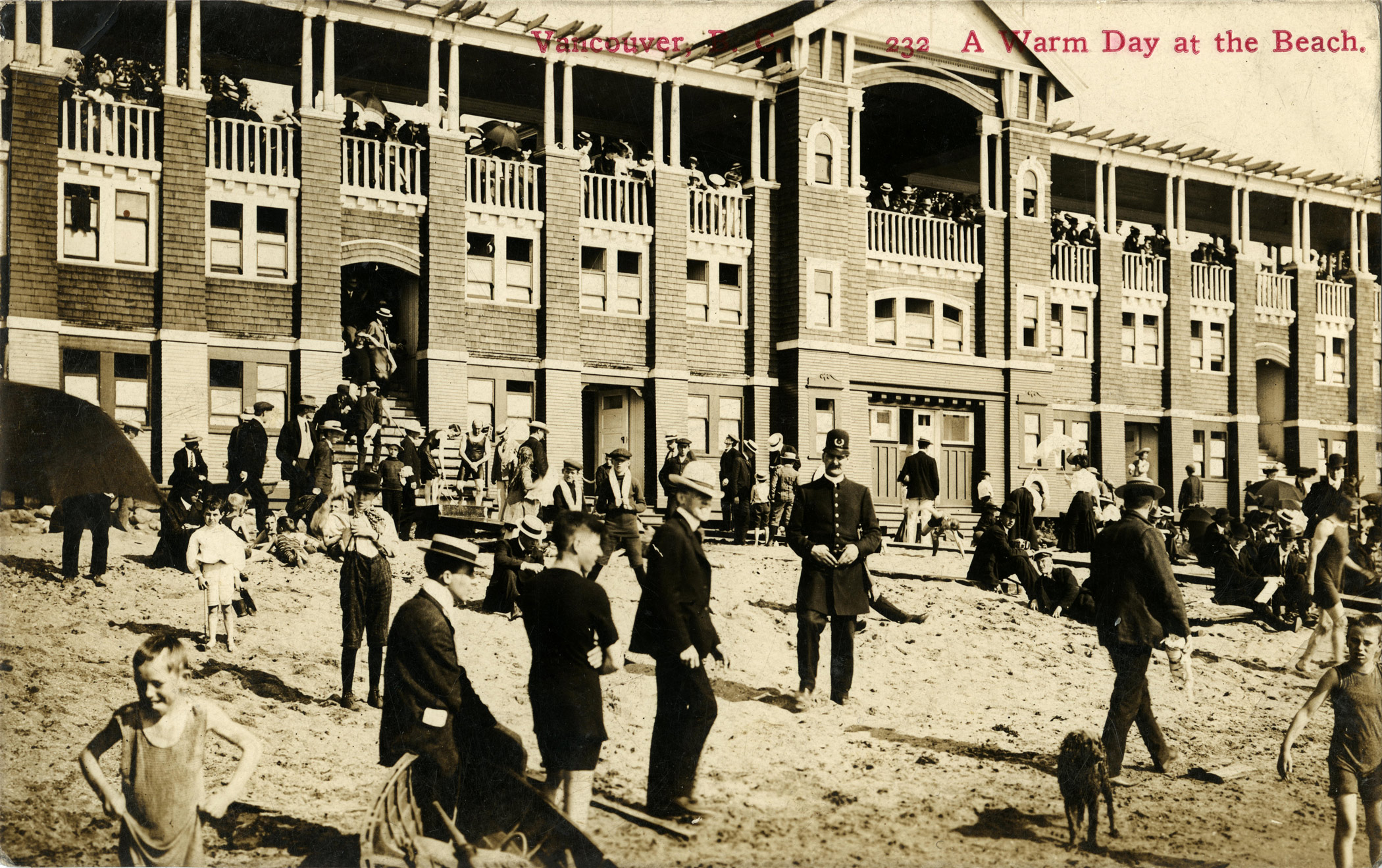
Timms, Philip T. A warm day at the beach, Vancouver B.C., [1906].
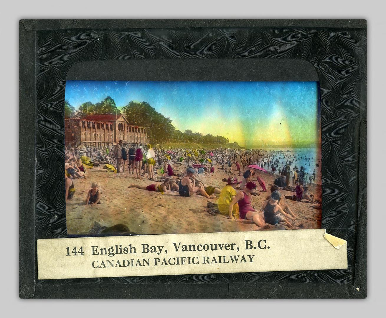
English Bay, Vancouver, B.C., [between 1930 and 1939?].
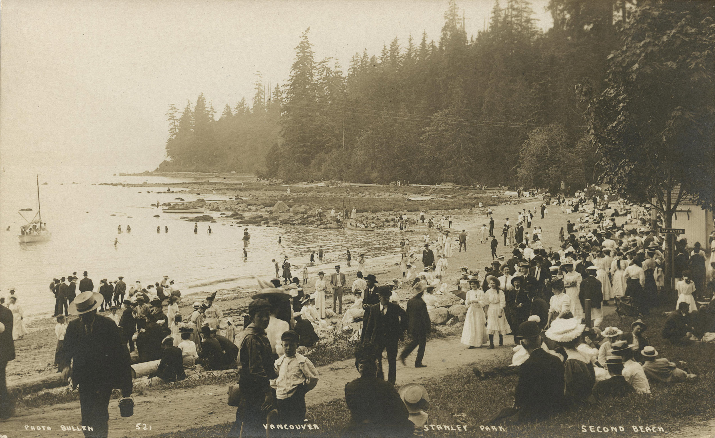
Bullen, Harry Elder. Stanley Park, Second Beach, [between 1910 and 1920?].
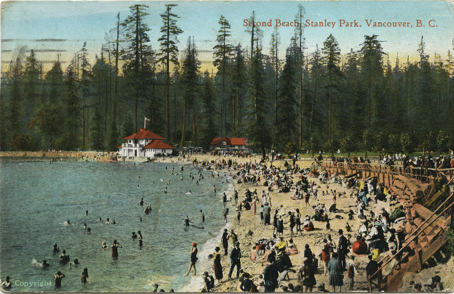
Second Beach, Stanley Park, Vancouver, B.C., [between 1920 and 1927?].
This photo shows several 1920s businesses near Crescent Beach in Surrey, including an ice cream parlor and a shop selling fish and chips:
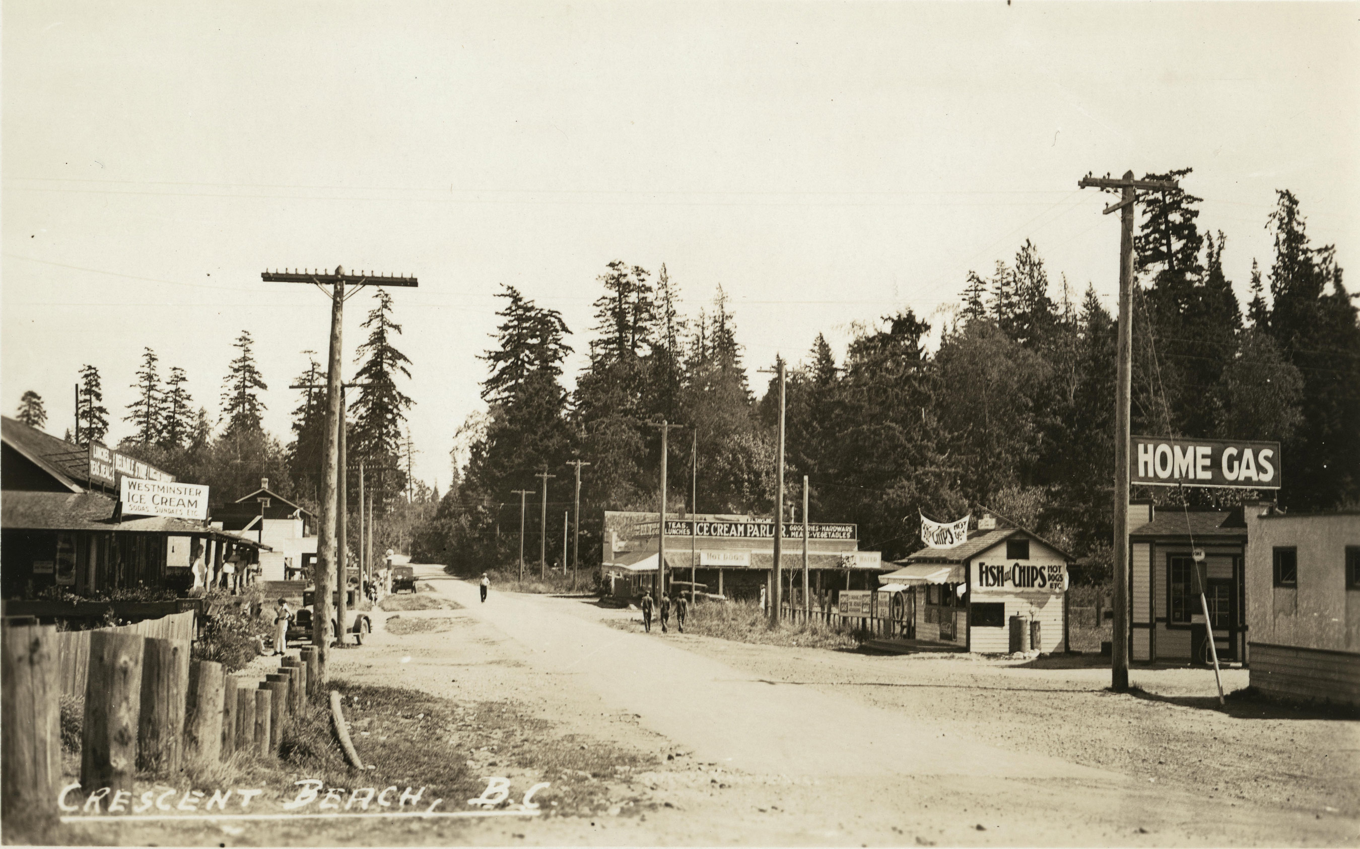
Crescent Beach, B.C., [between 1920 and 1930?].
This postcard shows a bustling day at Boundary Bay, close to the Canada/U.S. border:
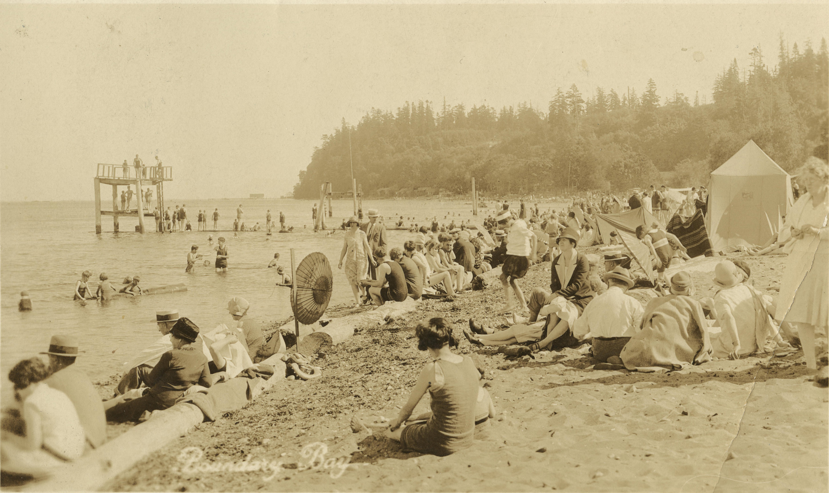
Boundary Bay, [between 1905 and 1915?].
In this postcard, swimmers and boaters enjoy the beach at Whytecliff Park in West Vancouver:
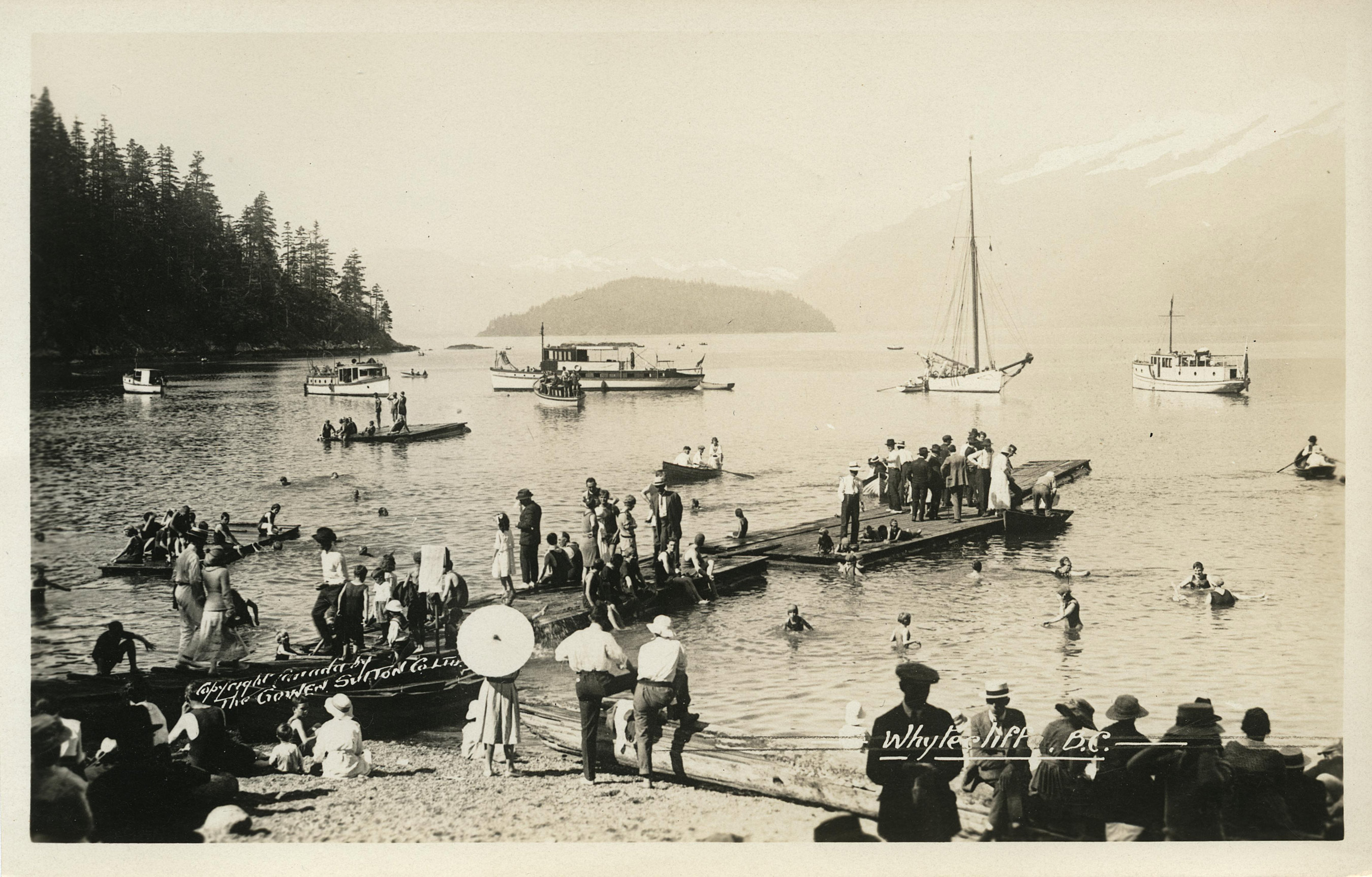
Whytecliff, B.C., [between 1920 and 1935?].
In Powell River, Willingdon Beach is a serene location for enjoying the beach and camping:
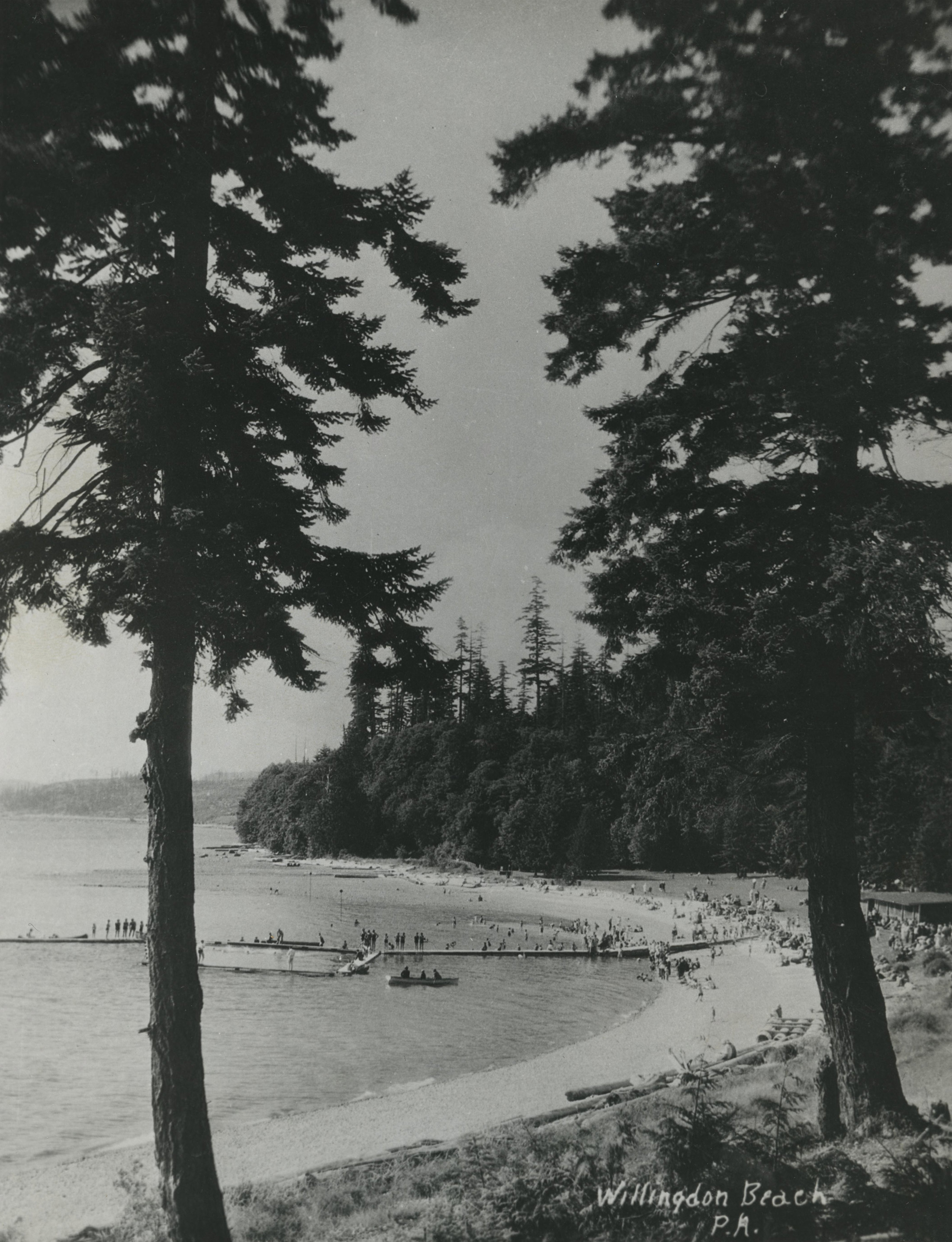
Powell River Studios. Willingdon Beach, 1947.
We hope you get the chance this season to visit the nearby beaches and other vacation spots around the province to enjoy what B.C. has to offer.